Landscape Consolidation
Landscape Consolidation is the English term for something more readily practised in recent years in Holland, Belgium and northern France, which is the restructuring of existing fragmented agricultural land holdings. It is comparable to the the historical enclosures of England, which were usually designed by surveyors.
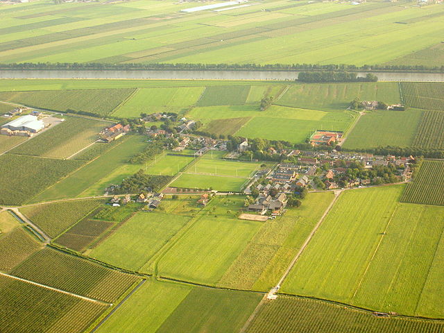
In Holland, it has involved landscape architects taking the lead. It has involved the re-planning of fragmented land holdings along with new drainage and road layouts and new buildings, in effect a redesign of the whole landscape. This consolidated different plots in the same ownership and so brought them together. So leading to economies in farming. Fragmentation was a consequence of inheritance laws,
The first ruilverkaveling in the Netherlands was in the Ballumer Mieden on Ameland in 1916 where the number of plots of 3659 were reduced to to 500. In 1919 followed a similar scheme in the Noordlaader Made in the east of the Oostpolder te Noordlaren. The Wet op de Ruilverkaveling (Law on Land Consolidation) of 1924 enabled such consolidation schemes to proceed despite the opposition of a small number of owners. The 1930s economic crisis and the Second World War led to concerns about food security and so prompted further land consolidation.
Usually a land consolidation plan is established by the Provincial Council or the municipality. The land users then follow this plan. By the 1960s landscape architects from the Dutch State Forestry Service (the Staatsbosbeheer) were actively involved in planning such landscape consolidation schemes.
In Belgium, land consolidation started in 1956, with the aim of improving agricultural structures. In 1970 a new law was passed. In addition, it became possible to carry out re-allotment in the context of landscape care. In 1978 this law was further revised with more opportunities for nature and environmental conservation.
In Germany Flurbereinigung takes place under the Flurbereinigungsgesetz (FlurbG) or landscape consolidation act and increasingly is motivated by nature conservation concerns, such as set-aside or water management, or construction of new infrastructure such as roads or rail, as well as agricultural and village settlement development. A more particular form of Flurbereinigung took place in wine growing areas to enable the introduction of mechanical harvesting.
The national organisation in Germany is the Bundesverband der Teilnehmergemeinschaften (BTG) e. V. ref. http://www.btg-bund.de/
In France remembrement began in the eighteenth century and became widespread in the Paris basin during the nineteenth century, generally supported by local authorities. It intensified after World War II, due to mechanisation of farming. So far about 15 million hectares of farmland has been consolidated and 750,000 km of hedgerows have been removed. Because of concerns about loss of habitat and biodiversity, there have been counter measures and it can be argued that since the л Loi relative au Dщveloppement des Territoires Ruraux ╗ (LDTR du 23 fщvrier 2005) remembrement has been formally abolished.