Lambeth Cycling Strategy should be based on Strava Metro Data
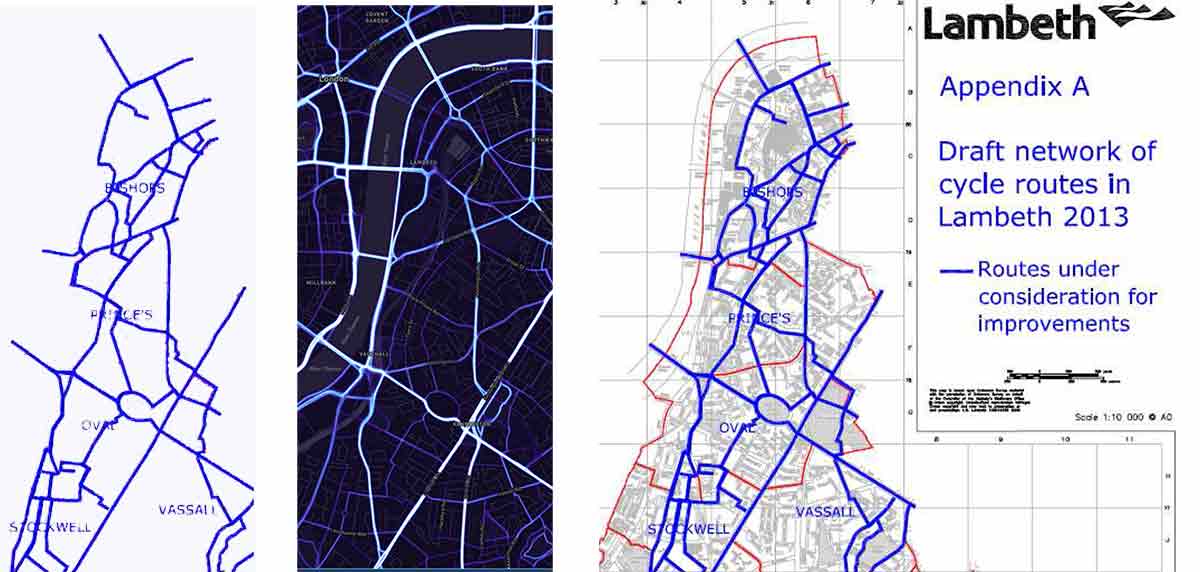
Cycle network and route planning, as discussed, should be based on supply and demand. Cycle planners need to know where cyclists want to ride and they need to know what routes are feasible. The best available data on actual usage, and therefore a strong indicator of demand, is the data collected by the Strava App. The centre map, above, shows current cycle flows and is constantly updated. It is a simple map and it shows the cycling network which should be built in this part of London. The left and right maps, published by Lambeth Council in 2013, only shows ‘improvements’ and is not based on demand. Doubtless, what they had in mind at the time, was a traditional London ‘paint job’, by which I mean some white lines etc on the road and yet more signs telling us we have cycle routes. This is a bad approach to cycle network planning.
Tom Turner